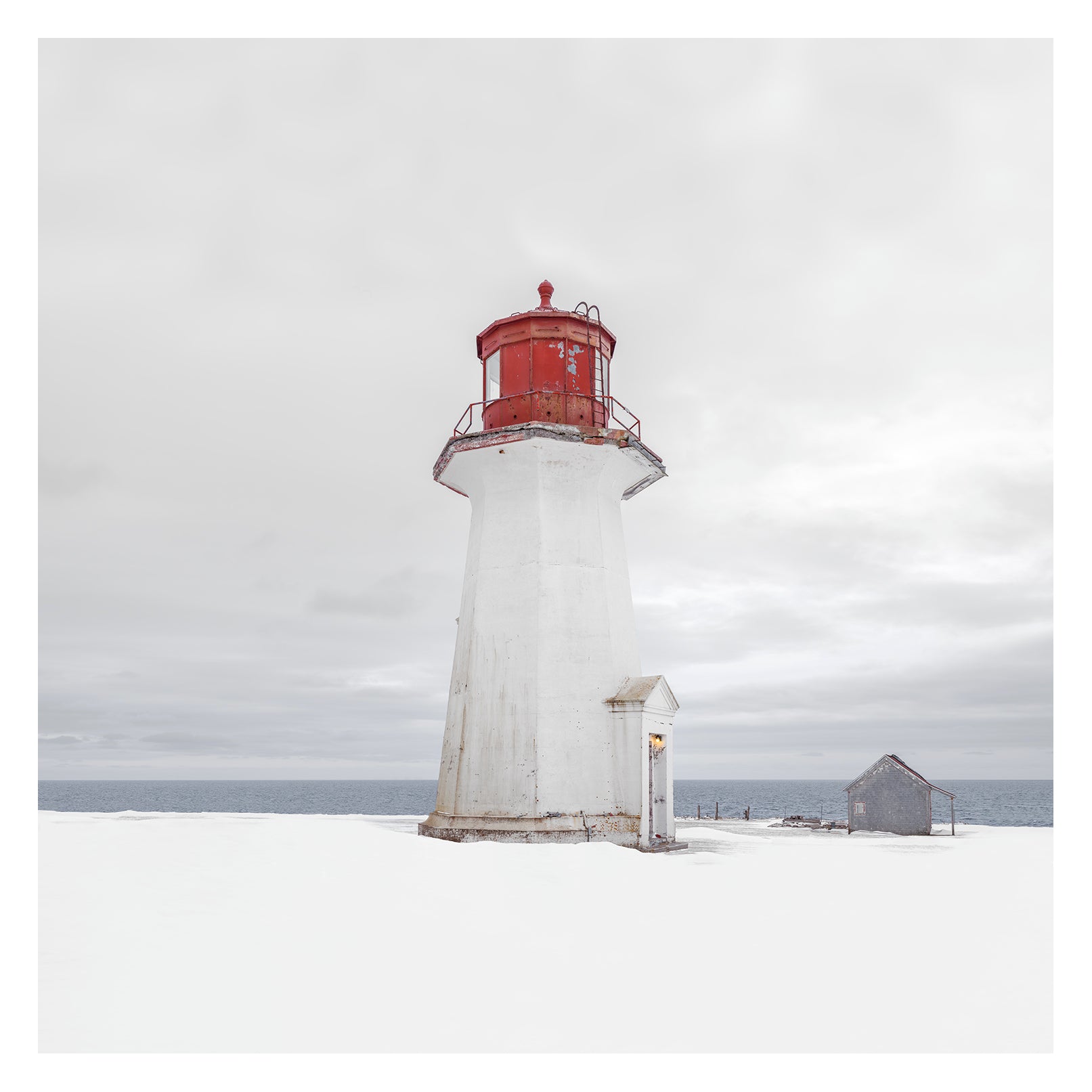
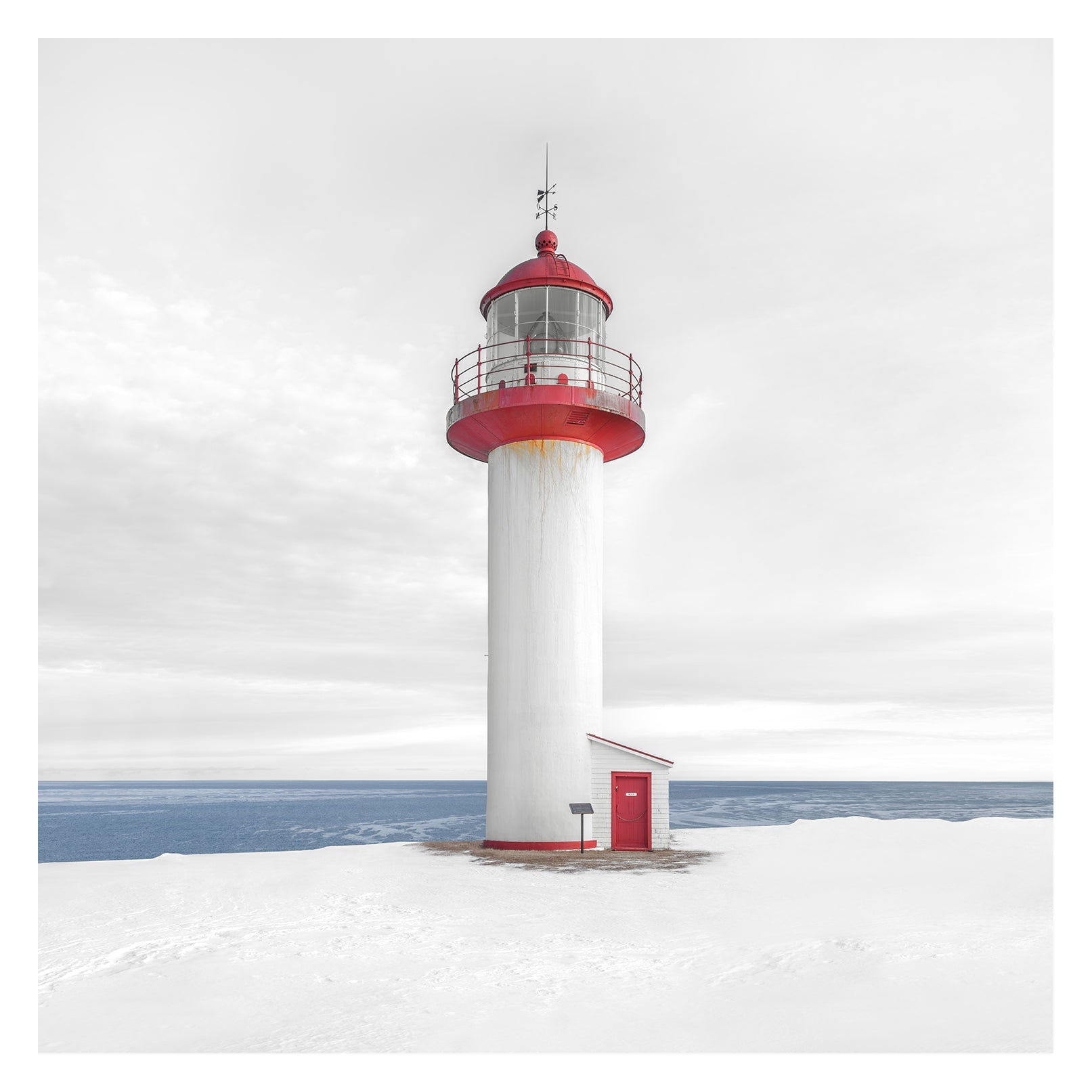
Lighthouse # 016, Cap d'Espoir, Golfe du St-Laurent, Québec, Canada
$2,800.00
Height | 46 ft. (14 m)
Geographic position | 48°25'08.0"N 64°19'05.2"W
Elevation on earth | 39 ft. (12 m)
Cap d’Espoir Lighthouse, is situated at the north-east entrance to Chaleur Bay. Initially noted on English charts as "Cape Despair," it actually translates to "Cape of Hope." Tradition recounts a fleet's wreck in 1711, leading to the abandonment of an attack on Quebec. Parliament approved funds for the lighthouse in 1871, with construction starting in 1873. It was completed in 1874, with a revolving light visible for fifteen miles. Keeper John Beck was appointed with a $400 annual salary. The lighthouse faced maintenance issues, including a broken revolving gear, which was promptly fixed. Keeper Beck expanded the living space in 1878. A fire damaged the tower's lantern room in 1883, leading to repairs. Further upgrades included a fog alarm in 1913 and replacement of the wooden tower with a concrete one in 1939. The current lighthouse exhibits a signature of four white flashes every thirty seconds and is still active under the Canadian Coast Guard's ownership, with the former keeper's dwellings now privately owned.
Keepers | John Beck (1874 - 1897), Charles Bourget (1897 - 1923), A. Beck (1923 - 1936), J. E. A. Beck (1936 - ),
Ref.: lighthousefriends.com
Limited Edition Archival Photograph
The photograph is printed in my atelier with archival pigment ink on archival fine art paper, 100% cotton fibre and acid free. The piece is numbered, signed and delivered unframed with a certificate of authenticity.
Please contact me for a conversation about this photograph or framing options.
[+ Inquire ]
Related Photographs

Lighthouse # 012, La Martre, Fleuve St-Laurent, Gaspésie, Québec, Canada, 2024
$2,800.00
Height | 63 ft. (19.2 m) Geographic position | 49°12'22.1"N 66°10'16.8"W Elevation on earth | 72 ft. (22 m) La Martre Lighthouse, named after Marten...
View full product details
Lighthouse # 018, Cap de la Madeleine, Fleuve St-Laurent, Québec, Canada, 2024
$2,800.00
Height | 55 ft. (17 m) Geographic position | 49°15'04.0"N 65°19'31.1"W Elevation on earth | 49 ft. (15 m) Cap de la Madeleine Lighthouse, located...
View full product details

Lighthouse # 022, Cape Spear (new), Atlantic Ocean, Newfoundland, Canada, 2026
$2,800.00
Height | 45 ft. (13.7 m) Geographic position | 47° 31' 16" N, 52° 37' 20" W Elevation on earth | 240 ft. (73 m) Built...
View full product details